Navigation & Utilities
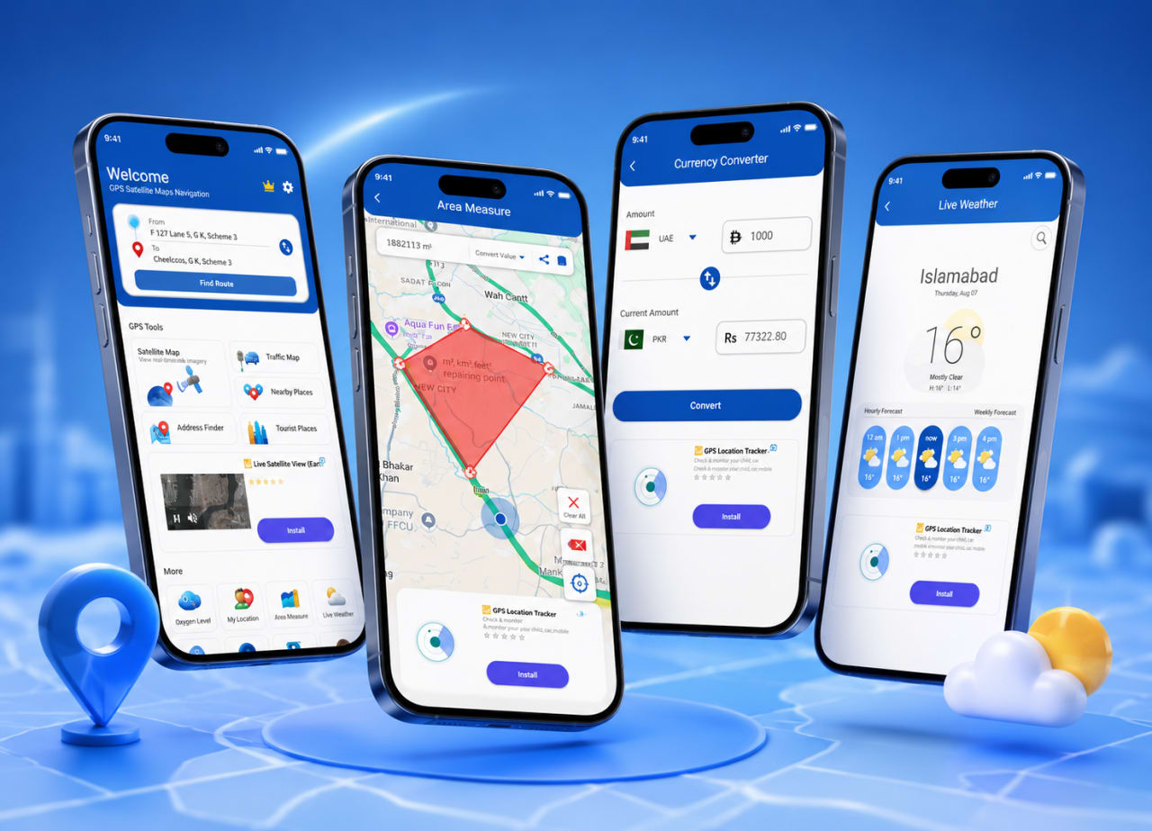
TerraNav GPS — Smart Navigation & Mapping App
Navigation concept with satellite maps, area measurement, weather, currency, and route planning — designed in Figma.
Project overview
TerraNav GPS is an advanced navigation and mapping application concept focused on outdoor navigation, smart route planning, and satellite map exploration.
Features
- Satellite & mountain maps
- Area measurement tools
- Live weather updates
- Multi-currency support
- Route navigation
- Terrain exploration interface
Services
Industry
Navigation & Utilities
Platform
Mobile UI/UX (Figma)
Timeline
2024
Region
Germany
Discovery & scope
We aligned on goals, user journeys, and success metrics before production work.
Design & iterate
Weekly design reviews and pragmatic tradeoffs kept delivery predictable.
Launch & handoff
Handoff assets and documentation so your team owns the roadmap.
Client feedback
“The UI design transformed our vision into a clean and modern navigation experience.”
TerraNav GPS — Product Owner
Related customer stories
More work from our portfolio — selected by overlapping services and industry.
Matched on: UI / UX Design · Figma
Lingua Translate — Smart Language Translator
Multilingual translator with dictionary, vocabulary, voice, and text translation — for learners and travelers.
VoiceBridge — AI Voice Translator & OCR
Real-time voice conversations across languages with OCR scanning — AI-powered communication design in Figma.
Wave Music — Music Streaming Application
Spotify-inspired mobile music app — playlists, discovery, and a smooth dark audio player in Figma.